
A line joining some fixed stations on main survey lines is:
📝 Detailed Explanation: Principal Lines in Chain Surveying
In chain surveying, a framework of triangles is used to map an area. Several types of lines are established to create this framework and locate details accurately. Understanding their purpose is key to understanding the survey process.
1. Tie Line
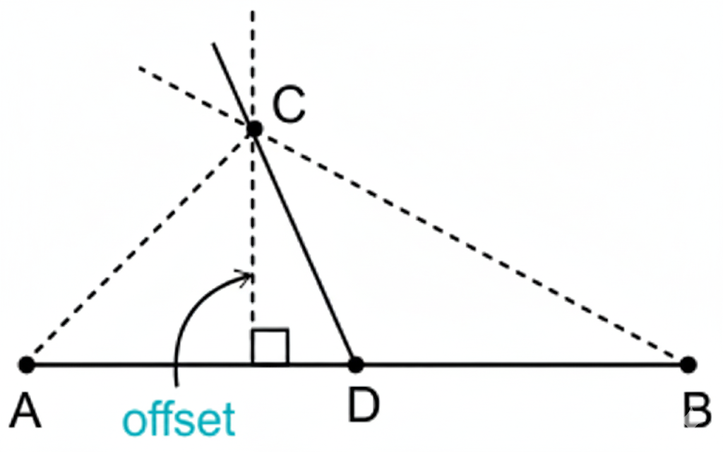
A tie line is a line that joins subsidiary or tie stations on the main survey lines. Its primary purpose is to locate interior details that are far from the main lines. By running a tie line, surveyors can take shorter, more accurate offsets to these details instead of long, error-prone ones. In the figure, the line CD is a tie line used to locate the feature at point C.
2. Base Line
The base line is the most important and longest line in a triangulation survey. It is laid with the highest possible precision and forms the foundation upon which the entire framework of triangles is built. All other measurements and computations are referenced back to the base line. In the figure, the line AB represents the base line.
3. Check Line (or Proof Line)
A check line is a line run in the field to verify the accuracy of the survey work. It connects known points within the survey framework (e.g., from the apex of a triangle to a point on its base). The length of the check line is measured on the ground and then compared to the length calculated from the plotted survey. If the two lengths match, it confirms the accuracy of the work.
💡 Summary of Lines
- Base Line: The main, longest line that forms the skeleton of the survey.
- Tie Line: A supplementary line to locate details and avoid long offsets.
- Check Line: A line used exclusively to check and prove the accuracy of the fieldwork.