Table of Contents
ToggleWhat is Surveying?
Surveying is the art and science of determining the relative positions of points on, above, or beneath the earth’s surface. It involves measuring distances, angles, and elevations to create accurate representations of land and its features. The primary purposes of surveying include:
- Preparing plans and maps
- Establishing property boundaries
- Measuring areas and volumes
- Selecting suitable sites for engineering projects
- Determining the dimensions and contours of the earth’s surface

Primary Divisions of Surveying
Surveying is fundamentally divided into two main categories, each with its own set of principles, applications, and methodologies:
1.Plane Surveying
Plane surveying is the foundation of most practical surveying work. It operates under the assumption that the earth’s surface is flat within the area being surveyed. This simplification is valid for smaller areas and offers several advantages:
- Scope: Suitable for areas up to approximately 260 square kilometers.(100 square miles)
- Methodology: Utilizes principles of plane geometry and trigonometry.
- Accuracy: For a distance of 18.2 km, the difference between the arc length and its subtended chord on the earth’s surface is only about 0.0152 m, which is negligible for most engineering purposes.
- Applications: Widely used in engineering projects such as:
- Designing and constructing highways, railways, and canals
- Building construction and urban planning
- Setting out property boundaries
- Calculating land areas for legal and development purposes
Key Features:
- Lines connecting survey points are treated as straight lines.
- Angles between these lines are considered plane angles.
- Vertical measurements are assumed to be parallel.
Plane surveying forms the basis for most engineering and construction projects due to its practicality and sufficient accuracy for areas of limited extent.
2.Geodetic Surveying
Geodetic surveying takes into account the curvature of the earth, making it suitable for surveying large areas with high precision. Its characteristics include:
- Scope: Used for surveying extensive areas where earth’s curvature becomes significant.
- Methodology: Employs principles of spherical trigonometry and advanced mathematical computations.
- Accuracy: Achieves a much higher degree of precision in both linear and angular measurements.
- Applications:
- Establishing national and international survey control networks
- Determining the precise shape and size of the earth
- Providing control points for subsequent plane surveys
- Supporting global mapping and navigation systems
Key Features:
- Lines connecting survey points are treated as arcs on a spherical surface.
- Angles between lines are considered spherical angles.
- Vertical measurements account for the variation in the direction of gravity.
- Utilizes sophisticated instruments and techniques, often including satellite technology.
Geodetic surveys are typically conducted by national survey departments, such as the Survey of India or the United States National Geodetic Survey. These surveys create a framework of precisely located points that serve as a reference for more localized surveys.
The choice between plane and geodetic surveying depends on several factors:
- Size of the area: Larger areas require geodetic methods to maintain accuracy.
- Required precision: High-precision projects may necessitate geodetic techniques even for smaller areas.
- Purpose of the survey: National mapping projects invariably use geodetic methods, while local construction projects typically employ plane surveying.
- Available resources: Geodetic surveying requires more sophisticated equipment and expertise.
Difference between Plane Surveying and Geodetic Surveying:
| Aspect | Plane Surveying | Geodetic Surveying |
|---|---|---|
| Earth's Surface Assumption | Assumed as a plane | Considered as a curved surface |
| Area Coverage | Small areas (up to 260 sq. km) | Large areas (beyond 260 sq. km) |
| Curvature Consideration | Ignored | Taken into account |
| Line Representation | Straight lines | Arcs |
| Angle Measurement | Plane angles | Spherical angles |
| Mathematical Basis | Plane geometry and trigonometry | Spherical trigonometry |
| Accuracy Level | Lower precision | Higher precision |
| Typical Applications | Local engineering projects, construction | National mapping, establishing control points |
| Instruments Used | Basic surveying instruments | Sophisticated and highly accurate instruments |
| Computational Complexity | Simpler calculations | Complex calculations and adjustments |
Classification of Surveys
1.Based on Purpose
a) Engineering Surveys: These surveys provide data for designing and executing engineering projects. They include:
- Construction surveys for buildings, bridges, and dams
- Infrastructure surveys for roads, railways, and canals
- Hydrological surveys for water supply and sewage systems
- Topographic surveys for land development projects
b) Military or Defense Surveys: Used to prepare maps of areas with military importance, these surveys are crucial for:
- Strategic planning and operations
- Identifying key terrain features and potential obstacles
- Mapping of enemy territories, including airports, ordnance factories, and missile sites
- Aerial reconnaissance for troop movements and armament concentration
c) Mine Surveys: These surveys are conducted to explore and manage mineral resources, involving:
- Surface and subsurface surveying to determine mineral locations and extents
- Delineation of mine workings and construction of underground plans
- Positioning of tunnels, shafts, and drifts
- Estimation of mineral reserves and planning of extraction methods
d) Geological Surveys: Aimed at understanding the composition of the earth’s crust, these surveys help:
- Identify different rock strata and geological formations
- Locate potential sites for economic minerals and oil deposits
- Assess geological structures like folds, faults, and unconformities
- Determine foundation treatments for major engineering projects
e) Geographical Surveys: These surveys are used to create maps depicting:
- Land use efficiency and patterns
- Irrigation sources and intensity
- Physiographic regions and water bodies
- Surface drainage systems and watershed boundaries
- Slope characteristics and contour patterns
f) Archaeological Surveys: Used to map and document ancient cultural sites and artifacts, these surveys are essential for:
- Locating and identifying buried relics of past civilizations
- Mapping ancient towns, villages, forts, and temples
- Conducting excavations based on survey data
- Preserving historical sites and understanding cultural evolution
g) Route Surveys: These surveys are specific to planning and laying out transportation routes, involving:
- Reconnaissance surveys to gather initial site information
- Preliminary surveys to establish control systems
- Location surveys to precisely position the route on the ground
- Detailed topographic surveys of the proposed route corridor
h) Cadastral Surveys: These surveys focus on land ownership and boundaries, used for:
- Determining property lines and calculating land areas
- Preparing revenue maps and legal property descriptions
- Settling boundary disputes and land registration
i) Hydrographic Surveys: These surveys deal with mapping water bodies and include:
- Charting shorelines and underwater topography
- Measuring water depths and locating underwater obstacles
- Studying tides, currents, and water levels
- Supporting navigation, port development, and coastal management
j) Photogrammetric and Remote Sensing Surveys: These modern surveying techniques involve:
- Aerial photography for large-scale mapping
- Satellite imagery for environmental monitoring and land use analysis
- LiDAR (Light Detection and Ranging) for precise 3D mapping
- Multispectral imaging for resource management and agricultural planninga
2.Based on Location
a) Land Surveys:
- Topographic Surveys: These depict the natural and artificial features of the land, including elevations, typically using contour lines. They also capture:
- Vegetation and land cover
- Drainage patterns and water bodies
- Man-made structures and infrastructure
- Terrain characteristics and landforms
- Cadastral Surveys: Used for determining property boundaries and calculating land areas, often for legal and tax purposes. These surveys also:
- Establish and maintain property records
- Support land registration systems
- Assist in resolving boundary disputes
- Provide data for land valuation and taxation
- City Surveys: These detailed surveys are used for urban planning, including the layout of roads, utilities, and other infrastructure. They also cover:
- Zoning and land use planning
- Public space and green area allocation
- Transportation network design
- Urban renewal and development projects
b) Hydrographic Surveys: These surveys focus on bodies of water, including coastlines, rivers, and lakes. They are crucial for navigation, water resource management, and marine construction projects. Additional applications include:
- Bathymetric mapping (underwater topography)
- Coastal zone management and erosion studies
- Environmental impact assessments of aquatic ecosystems
- Offshore energy development (e.g., wind farms, oil platforms)
c) Underground Surveys: Used in mining and tunnel construction, these surveys map subterranean features and structures. They also:
- Assess geological conditions and mineral deposits
- Plan and guide underground excavations
- Monitor ground stability and subsidence
- Support utility mapping for urban planning (e.g., sewers, subway systems)
d) Aerial Surveys: Conducted using aircraft or drones, aerial surveys are used to capture large areas quickly and are particularly useful for inaccessible terrain. They also provide:
- High-resolution imagery for mapping and modeling
- Data for volumetric calculations (e.g., stockpiles, earthworks)
- Rapid assessment capabilities for disaster response
- Support for precision agriculture and forestry management
3.Based on Instruments and Methods
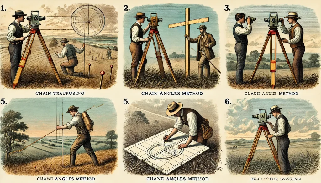
a) Chain Surveying: This basic method uses only linear measurements with chains and tapes. It’s suitable for small, open areas with few obstacles.
- Advantages: Simple, low-cost, and easy to learn
- Limitations: Time-consuming for large areas and prone to errors in uneven terrain
- Modern adaptations: Use of laser distance meters for improved accuracy

b) Compass Surveying: This method combines linear measurements with directional readings using a compass, allowing for the creation of closed traverses.
- Applications: Preliminary surveys, route surveys, and small-scale mapping
- Accuracy considerations: Subject to magnetic variations and local attractions
- Integration with other methods: Often used in conjunction with GPS for orientation

c) Plane Table Surveying: A graphical method where the map is drawn directly in the field, offering immediate visual representation of the area being surveyed.
- Key components: Plane table, alidade, plumbing fork, and drawing sheet
- Advantages: Provides real-time verification and is ideal for filling in details
- Modern equivalents: Digital plane tables with electronic data collection

d) Theodolite Surveying: Using a theodolite, this method allows for precise angular measurements, both horizontal and vertical, making it suitable for more complex surveys.
- Types: Optical, electronic, and gyrotheodolites
- Applications: Triangulation, traversing, and setting out works
- Advancements: Integration with EDM technology in total stations
e) Tacheometric Surveying: This method uses a special telescope with stadia wires to measure both horizontal and vertical distances, useful when direct measurements are difficult.
- Principles: Based on the principle of optical distance measurement
- Advantages: Rapid data collection in difficult terrain
- Modern developments: Electronic tacheometers with automatic readings
f) Triangulation Surveying: Used for large areas, this method divides the area into triangles and uses trigonometry to calculate distances based on a precisely measured baseline and observed angles.
- Applications: Establishing control networks for large-scale mapping
- Precision: Highly accurate for long distances
- Evolution: Integration with GPS for validation and strengthening networks
g) Electronic Distance Measurement (EDM): Modern surveying often employs EDM instruments, which use light or radio waves to measure distances with high accuracy.
- Types: Infrared, laser, and microwave EDM instruments
- Advantages: High precision, rapid measurements, and long-range capability
- Integration: Commonly incorporated into total stations and other survey instruments
h) Total Station Surveying: Total stations combine electronic theodolites with EDM capabilities and often include data collection and processing features.
- Features: Angular and distance measurements, data storage, and onboard calculations
- Applications: Topographic surveys, construction layout, and monitoring
- Advancements: Robotic total stations for one-person operation and increased efficiency.(Robotic total stations are advanced surveying instruments that can be operated remotely by a single person. They automatically track a prism held by the surveyor, allowing for faster data collection and increased efficiency compared to traditional two-person surveying teams.)
i) Satellite-Based Surveying: Global Positioning System (GPS) and remote sensing technologies have revolutionized surveying, allowing for precise positioning and data collection over large areas.
- Systems: GPS, GLONASS, Galileo, and BeiDou
- Techniques: Static, kinematic, and real-time kinematic (RTK) surveying
- Applications: Geodetic control, GIS data collection, and precision agriculture
- Developments: Integration with inertial measurement units (IMU) for enhanced accuracy. (Inertial Measurement Units (IMUs) are electronic devices that measure and report a body’s specific force, angular rate, and sometimes orientation. In surveying, IMUs are often integrated with GPS systems to provide continuous positioning data, especially in areas with poor satellite visibility.)
k) Photogrammetry: This technique uses photographs to make measurements and create maps and 3D models.
- Types: Aerial, close-range, and satellite photogrammetry
- Applications: Topographic mapping, architectural documentation, and archaeological surveys
- Advancements: Structure from Motion (SfM) techniques for automated 3D reconstruction
j) LiDAR (Light Detection and Ranging): This advanced remote sensing method uses laser pulses to measure distances and create detailed 3D models.
- Platforms: Airborne, terrestrial, and mobile LiDAR systems
- Applications: High-resolution topographic mapping, forestry, and urban modeling
- Advantages: Rapid data collection, high point density, and penetration of vegetation
F.A.Q.
Types of Survey
The two main divisions of surveying are Plane Surveying and Geodetic Surveying.
Plane surveying is generally suitable for areas up to approximately 260 square kilometers (100 square miles).
Geodetic surveying is used for surveying large areas where the earth’s curvature becomes significant, for high-precision projects, and for establishing national and international survey control networks.
Topographic surveys depict natural and artificial features of the land, including elevations, while cadastral surveys are used for determining property boundaries and calculating land areas, often for legal and tax purposes.
Triangulation is used for surveying large areas by dividing them into triangles and using trigonometry to calculate distances based on a precisely measured baseline and observed angles.