Table of Contents
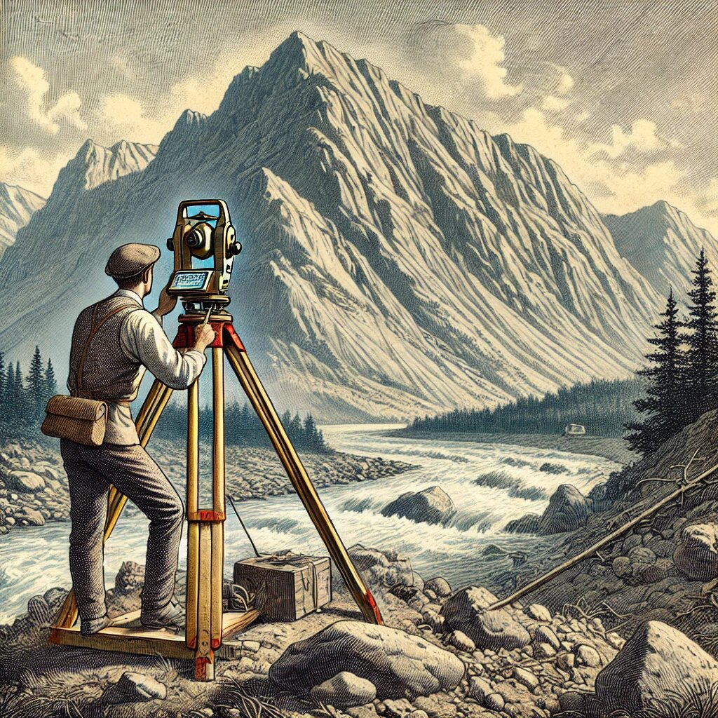
ToggleTriangulation is the method of determining positions on the Earth’s surface by measuring angles between a network of triangles formed by stations or points marked on the ground. This process involves creating a connected system of triangles and using the known angles and the length of one side to calculate the remaining distances. The accuracy of triangulation makes it a vital technique in surveying for establishing control points and precise measurements across large areas.
Classification of Triangulation
Triangulation is a cornerstone of geodetic and topographical surveys and is classified into three main categories based on quality, accuracy, and purpose:
- Primary Triangulation,
- Secondary Triangulation
- Tertiary Triangulation.
1. Primary Triangulation (First-Order Triangulation)
Primary triangulation is the most accurate and highest-grade form of triangulation. It is employed for tasks that demand the utmost precision, such as determining the Earth’s shape and size or establishing control points for extensive survey projects. These control points form the foundation for connecting smaller, less precise surveys.
Stations in primary triangulation are usually spaced between 16 and 150 kilometers apart, depending on the terrain and the scope of the project. Every possible effort is made to ensure that the measurements are as accurate as possible. This involves meticulous care in observing linear, angular, and astronomical measurements, as well as ensuring that the calculations derived from these measurements are free from error.
Given its level of accuracy, primary triangulation is used in tasks such as geodetic surveys, mapping national borders, and creating precise national frameworks. High-tech instruments and rigorous procedures are employed to minimize errors, making this the most critical type of triangulation for large-scale, high-stakes projects.
2. Secondary Triangulation (Second-Order Triangulation)
Secondary triangulation offers a slightly lower level of precision compared to primary triangulation but is still highly accurate. It is used to create additional control points that link primary triangulation networks or provide a more localized control system for smaller regions. Secondary triangulation is essential in filling gaps between the primary stations.
Stations in this category are typically spaced between 10 and 25 kilometers apart. While the precision of measurements in secondary triangulation may not be as high as in primary triangulation, it is still adequate for most regional surveys. In cases where environmental conditions prevent achieving the accuracy required for primary triangulation, the system may be downgraded to secondary triangulation.
Secondary triangulation plays a crucial role in expanding the control network established by primary triangulation, allowing for more detailed and localized surveys. This type of triangulation is commonly employed in urban planning, regional development projects, and infrastructure surveys.
3. Tertiary Triangulation (Third-Order Triangulation)
Tertiary triangulation is the least precise form of triangulation and is primarily used for localized surveys. It provides control points between primary and secondary stations, ensuring that smaller areas can be surveyed with sufficient accuracy for specific projects. While tertiary triangulation is less accurate than its higher-order counterparts, it is still vital for many practical applications, such as construction, topographical mapping, and smaller-scale engineering projects.
In India, tertiary triangulation is commonly referred to as “topo triangulation,” and it provides immediate control for topographical surveys at various scales. The distance between tertiary triangulation stations is much shorter, often less than 10 kilometers, allowing for detailed and accurate surveys over smaller areas.
Layout of Triangulation
The layout of triangulation refers to the arrangement of triangles in a triangulation system. Depending on the terrain and the level of accuracy needed, triangulation layouts can be classified into different configurations. Each configuration is designed for specific purposes and has advantages and limitations. Triangulation layouts can generally be classified into three types:
- Simple Triangles in Chain
- Braced Quadrilaterals
- Centered Triangles and Polygons
1. Simple Triangles in Chain
This layout involves a series of simple triangles arranged in a chain . It is commonly used when control points need to be established in narrow strips of terrain, such as valleys located between ridges. The simplicity of this layout makes it both fast and economical, as it only requires sighting four stations. Since it doesn’t involve the measurement of long diagonals, it is more straightforward to execute. However, this simplicity also comes with a drawback: there is no built-in method for checking the accuracy of the measurements. The system relies solely on the measurements of one route to compute distances, leaving it vulnerable to accumulated errors over long distances.
To counter this risk, it is necessary to introduce check baselines and conduct frequent astronomical observations for azimuth. These checks help control the accumulation of errors and ensure that the triangulation remains accurate despite its limitations.
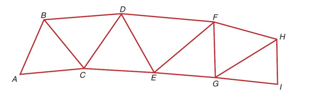
2. Braced Quadrilaterals
A layout of braced quadrilaterals consists of triangles arranged to form quadrilaterals, with the diagonals also being observed. This system is considered one of the most reliable and accurate forms of triangulation. In braced quadrilaterals, four stations are positioned at the corners of the figure, and the diagonals are measured to provide additional observations. The inclusion of these diagonals allows for the calculation of side lengths from multiple angles and combinations, which helps reduce errors and improve the accuracy of the measurements.
This arrangement is highly favored because it provides a natural check on both the angles and the lengths of the sides, ensuring more consistent and reliable results. The interlocking system of triangles in braced quadrilaterals enables the surveyor to verify the accuracy of their observations continuously. As a result, this layout is often used for surveys requiring a high degree of precision, such as geodetic control surveys.

3. Centered Triangles and Polygons
The centered triangles and polygons layout is typically employed when a large area needs to be surveyed, especially when the area has dimensions that extend in multiple directions. This system consists of polygons and triangles with central stations, which are used to improve control across vast areas. The polygons formed can vary in shape, commonly taking the form of quadrilaterals, pentagons, or hexagons, with one central station in each.
This layout offers significant benefits in terms of accuracy. Since measurements are taken from multiple directions toward a central station, the layout provides a robust method for checking and controlling errors. This configuration makes it ideal for covering large and complex areas where multiple points of reference are needed.
Despite the enhanced accuracy and control this layout provides, there is a downside: the progress of the survey tends to be slow. This is primarily due to the additional time and effort required to set up instruments at multiple stations, as well as the need for a higher number of observations.

Frequently Asked Questions
Triangulation in surveying is the method of determining positions on the Earth’s surface by measuring angles between a network of triangles formed by stations or points marked on the ground. This system allows for accurate distance measurements using one known side of a triangle and the measured angles.
The triangulation method involves creating a series of interconnected triangles. By measuring the angles and the length of one side, surveyors can calculate the remaining distances and control points, ensuring accurate measurements over large areas.
Triangulation in surveying is classified into three main types:
- Primary Triangulation: High precision, used for large-scale surveys like geodetic control.
- Secondary Triangulation: Intermediate precision, used to fill in control points between primary stations.
- Tertiary Triangulation: Lower precision, used for local surveys.
Geodetic surveys use primary triangulation to establish large-scale control networks. Secondary and tertiary triangulations are then used to extend the network and provide detailed local control.
A tower in a triangulation survey is often used when visibility is obstructed, such as in forested or hilly areas. The tower elevates the instrument above ground obstructions, allowing for clear lines of sight between triangulation stations.
Towers are used in triangulation surveys to ensure that the surveyor has a clear line of sight between stations, especially in difficult terrains like forests or mountainous regions where natural obstructions would hinder accurate measurements.
In triangulation, distance angles refer to the angles measured between stations in a triangle. These angles, combined with the length of one known side, are used to calculate the remaining distances and locations of points in the survey.